Countries of the world for kids starts with one friendly word: hello. On this page your child taps a country and hears how children there greet each other: Namaste in India, Nǐ hǎo in China, Konnichiwa in Japan, Marhaba in the UAE, Bonjour in France, Hola in Mexico, Olá in Brazil, Jambo in Kenya, Privet in Russia, Halo in Indonesia, G'day in Australia, and Hello in the UK and the USA. Each country card also shows its flag, a famous animal, a food and a landmark, all spoken in Hindi and English.
For a child of three to six, the world is "my home, my street, my city". Learning a few countries this way, through a greeting, an animal and something to eat, makes other places feel friendly rather than far away. It also gives children from those countries, and their classmates, the happy moment of "That's my hello!"
The 13 countries, their hello words and flags
We picked countries from every inhabited continent, with the places Indian families most often visit, work in or have relatives in. Every flag is drawn carefully with the right colours and shapes.
| Country | Hindi name | Hello | Animal | Food | Landmark |
|---|---|---|---|---|---|
| India | भारत | Namaste | Tiger | Roti | Taj Mahal |
| China | चीन | Nǐ hǎo | Panda | Dumplings | Great Wall of China |
| Japan | जापान | Konnichiwa | Snow monkey | Sushi | Mount Fuji |
| UAE | यूएई | Marhaba | Camel | Falafel | Desert |
| Indonesia | इंडोनेशिया | Halo | Orangutan | Rice | Mount Bromo volcano |
| Russia | रूस | Privet | Brown bear | Blini pancakes | Saint Basil's Cathedral |
| United Kingdom | ब्रिटेन | Hello | Fox | A cup of tea | Castles |
| France | फ़्रांस | Bonjour | Rooster | Croissant | Eiffel Tower |
| Kenya | केन्या | Jambo | Lion | Maize | Mount Kenya |
| USA | अमेरिका | Hello | Bald eagle | Pancakes | Statue of Liberty |
| Mexico | मेक्सिको | Hola | Monarch butterfly | Tacos | Chichén Itzá pyramid |
| Brazil | ब्राज़ील | Olá | Parrot | Beans | Football stadium |
| Australia | ऑस्ट्रेलिया | G'day | Kangaroo | Pie | Sydney Opera House |
In the UAE and many Arab countries people also say "As-salaam alaikum". In Kenya, "Jambo" is a friendly Swahili hello; many Kenyans also say "Habari". We chose the easiest word for small mouths.
How to use the world map game
Say hello: the map
The map shows five continents as colourful islands: Asia, Europe, Africa, the Americas and Oceania. Each island holds big flag buttons for its countries. When your child taps a flag, the country card opens: a large flag, the country's name, and a big speech bubble with the hello word. The voice says, for example, "In Japan, people say Konnichiwa!" in English and "जापान में लोग कोन्निचिवा कहते हैं!" in Hindi. Tap the bubble to hear it again. Tap the animal, food or landmark pictures to hear their names. Tap Map to go back and choose another country. After exploring four countries, your child earns a marble in the Goli Jar.
Flags: find the flag
The flags game says "Find the flag of France" and shows two to four flags, depending on the age set in the grown-up settings. It is a gentle flag matching game: a different flag gets its name read out and another try, the right flag glows after two tries, and a hand points to it after three. No timer, no score, no "wrong" buzzer.
Festivals
The third tab opens our festivals for kids explorer, where children learn how people celebrate Diwali, Eid, Christmas, Lunar New Year, Carnival and more.
What children learn about countries at each age
| Age | What is realistic | Try this |
|---|---|---|
| 3-4 years (nursery) | Knows India's flag; enjoys saying 2-3 hello words; names animals from other places | Explore India, then one country where family or friends live |
| 4-5 years (LKG) | Knows the world has many countries; says 4-6 hello words; recognises 3-4 flags | Flags game with 3 choices; hello word of the day at breakfast |
| 5-6 years (UKG) | Names continents; links a country to its animal, food or landmark; recognises 6-8 flags | Find the countries on a real globe or atlas; sort countries by continent |
At this age geography for kids is about belonging and curiosity, not capitals and borders. The IB PYP, the UK EYFS "Understanding the World" goal and India's NCF-FS all ask young children to notice similarities and differences between people and places. Saying hello in another language is one of the easiest ways to do that.
How to teach countries of the world at home
- Hello of the day. Pick one country each morning. Tap it, listen, and use that hello all day with family members. By the end of two weeks your child knows 13 ways to say hello in different languages.
- Find it on a globe. If you have a globe or a world map poster, find the country after playing. Point to India first, then trace the way to the new country with a finger.
- Kitchen trip. Many of the foods are easy to find: roti, rice, corn, beans, pancakes, tea. Name the country as you eat: "Pancakes are loved in the USA and in Russia too."
- Animal walk. Move like the animals: hop like a kangaroo, stomp like a bear, fly like an eagle. Our wild animals name and animals name pages have many more.
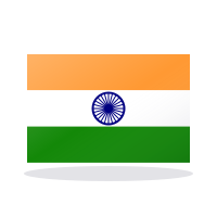
- Flag art. Colour a paper flag of India with saffron, white and green, and draw the blue wheel with 24 spokes. Talk about our national symbols of India.
Make it personal. If an aunt lives in Dubai or a friend moved to London, start there. Children remember countries attached to people they love.
Fun facts about countries for kids
- India's flag has a blue wheel, the Ashoka Chakra, with 24 spokes. You can count them on the big flag in the game.
- Japan's flag is a red circle on white. The circle stands for the sun, and Japan is often called "the land of the rising sun".
- The USA flag has 50 stars, one for each state, and 13 stripes.
- Australia's flag shows the Southern Cross, stars you can see in the night sky south of the equator.
- Snow monkeys in Japan sit in warm springs in winter to keep cosy.
- Monarch butterflies fly thousands of kilometres to spend the winter in the forests of Mexico.
- Kenya's flag has a shield and two spears in the middle, from the Maasai people.
Tips for calm, inclusive play
Talk about every country with the same warmth. Every place has homes, schools, grandparents and favourite foods, just like ours. If your child laughs at a new word, laugh with them and try saying it together. Words from other languages sound funny to everyone at first.
For children with speech delay, it is fine to just tap and listen; there is no need to repeat each word. For autistic children, turn on calm mode and begin with one or two countries they already know. In bilingual or trilingual homes, add your own home language's hello to the list. Keep screen time short and shared: sit together, say hello back to the screen, then find something real to do. Children under two learn best from a grown-up and real objects.
Looking for a countries worksheet or countries chart for LKG or UKG? Print this page: the country table above prints neatly with hello words, animals, foods and landmarks. There is no separate PDF.